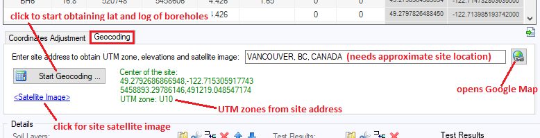
Geocoding
Geocoding is the process of transforming a description of a location -such as a pair of coordinates, an address, or a name of a place- to a location on the earth's surface. This is particularly useful when you want to prepare the 3D model in Google Earth or obtain satellite image for a site. Both these features require geographical coordinates (i.e. latitude and longitude). VisLog uses Google server for geocoding. You can start geocoding by entering the approximate location of the site. By pressing the "Start Geocoding" button, the following steps will be taken by the program:
|